Where the canyon is and how you get there from Side
Köprülü Canyon National Park sits in the hinterland between Serik and Manavgat, at the point where the Taurus Mountains rise abruptly behind the coastal plain. The Turkish Ministry of Culture and Tourism puts it 63 kilometres from the centre of Manavgat: you leave the D400 coast road at the Taşağıl junction and climb roughly 37 kilometres north through Beşkonak into the valley.
From Side that works out at approximately 60 to 65 kilometres — allow about an hour of actual driving, and a little more once the hotel pickup round is added. On our tours the pickup begins at roughly 08:00 to 08:30; the exact time depends on your hotel and is confirmed personally after you book.
The Köprüçay and the gorge it carved
The river is the Köprüçay, the Eurymedon of antiquity. It rises in the Taurus near Sütçüler in Isparta province and reaches the Mediterranean in the Serik district, flowing past Aspendos and out at Boğazkent. Much of its water comes not from rain but from karst springs — which is why it runs greenish-blue, and why it keeps flowing through the dry Mediterranean summer.
Between the villages of Bolasan and Beşkonak the wide valley closes into a gorge 14 kilometres long, one of the longest in Turkey. The Ministry of Culture describes walls of more than 100 metres; geographers from Ankara University measured up to 400 metres in places. The cut runs through conglomerate and older limestone, and that limestone has produced karst all around: springs, caves, fluted rock. The park spans elevations from 150 to 2,500 metres, and its summit, Bozburun, reaches 2,505.
The Roman bridges
The park is named not for the river but for its bridges — köprülü means “with a bridge”. The best known is the Oluk bridge (Oluk Köprü), about five kilometres north of Beşkonak. Built in the 2nd century AD, when Selge was at its height, it crosses the river high above the water on a single arch: around 14 metres long, 3.5 metres wide, with a span of about seven metres, the stones fitted without mortar. It carried the road that climbed from the Pamphylian coast into the Pisidian highlands, and it is still in use.
The second, the Büğrüm bridge, spans the Kocaçay tributary — also Roman, also a single arch. A modern bridge now takes the traffic and the old one is protected. The Ministry of Culture lists both bridges, together with the stone-paved ancient road to Selge, as the most striking monuments in the area. For comparison: 42 kilometres downstream at Aspendos, another bridge on Roman foundations crosses the same river.
Selge, the city above the gorge
High above the west bank, at roughly a thousand metres, lie the remains of Selge, a hill city of Pisidia on the southern slope of the Taurus. Strabo records a Spartan foundation and mentions an older attribution to the seer Calchas; the city passed under Lydian, Persian, Macedonian and Roman control and reached its greatest extent under Rome, when Strabo gives its population as 20,000.
The best-preserved building is the rock-cut theatre, renovated in the 3rd century AD. Around it stand the agora, a stadium and gymnasium, the remains of temples to Zeus and Artemis, walls, an acropolis, a necropolis, cisterns and water channels. The present-day village of Altınkaya — formerly Zerk — sits among the ruins, and ancient blocks show in some house walls. Selge lies within the national park and is reached by a mountain road from the valley; in antiquity a paved road up to two metres wide climbed to it from the Oluk bridge.
Cypress, pine and what else grows here
The park's botanical showpiece is a natural cypress forest of about 400 hectares. The Ministry of Culture and Tourism calls it the largest natural cypress forest in the entire Mediterranean region; the Ministry of Agriculture and Forestry calls it the largest in Turkey; forestry science treats Köprülü Canyon as the most important natural occurrence of the Mediterranean cypress (Cupressus sempervirens), mixed in places with Turkish pine (Pinus brutia).
The slopes belong to Turkish pine and black pine, with sessile oak; higher up come Lebanon cedar, Cilician fir and juniper. Between 150 and 2,500 metres the Ministry records 48 rare or threatened plant species, 44 of them endemic. For fauna the same source names the wild goat, Krüper's nuthatch, the griffon vulture and a salamander found only in this area; the river itself is known for its trout.
A national park since 1973 — what protection means
The area was declared a national park on 12 December 1973. The current list kept by the General Directorate of Nature Conservation and National Parks (DKMP) records 47,473 hectares — older sources give 36,614 — spread across Antalya and Isparta provinces. In July 2026 the Ministry of Agriculture and Forestry gave the park its own directorate, to bring protection, enforcement and visitor management under one roof.
The legal basis is National Parks Law No. 2873. Its Article 14 forbids, in any national park, disturbing the natural and ecological balance, destroying wildlife, polluting soil, water or air, upsetting the balance through hunting, grazing or timber extraction, and building without an approved plan. For a visitor that comes down to something simple: whatever you bring in goes out with you, and the ruins, the bridges and the forest stay as you found them.
The rafting run — one slice of the park
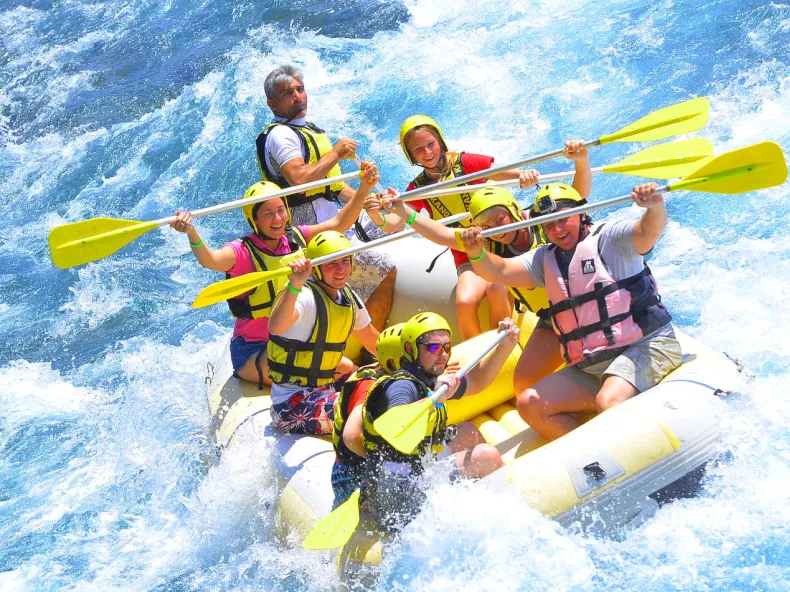
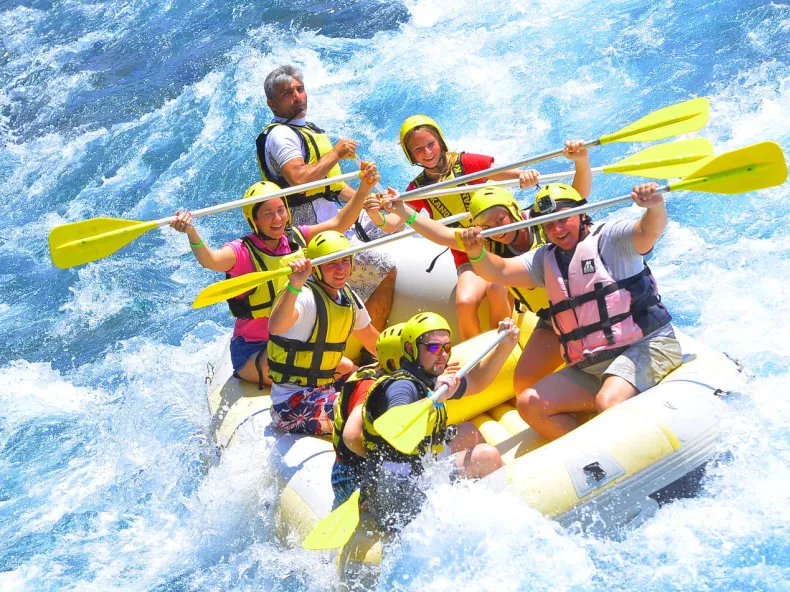
Our tours cover 12 kilometres of the Köprüçay. The base is inside the valley itself, with changing rooms, showers, toilets, secure storage and a restaurant on the bank. Before the start there is a briefing and a practice session; a certified guide sits in every raft, and helmet, life jacket and paddle are provided. From Side the day costs from 18 € per adult, paid on the day of the tour.
Put that in proportion: 12 river kilometres in a 14-kilometre gorge, inside a park of more than 47,000 hectares. From the raft you see the walls, the karst water and the forest — but not Selge, and not the cypress slopes in their full extent. And white water is white water: the equipment and the guides reduce the risk, they do not remove it. Non-swimmers can take part; anyone who is pregnant, has a serious heart or respiratory condition or has recently had surgery stays on the bank.
When the day is worth it
The southern slopes of the Taurus catch the moist air off the sea: the Beşkonak weather station averages around 1,115 millimetres of rain a year, more than Manavgat on the coast, with the maximum in January and the minimum in July. Summer is therefore dry and hot — and the river still runs, because of the springs. The newspaper Sabah puts visitors at an average of 600,000 a year, with the rush in July and August.
If you want more than the view from the raft, plan time: for the Oluk bridge, for the mountain road to Selge, for a walk into the cypress forest. Besides rafting, the Ministry of Culture lists canoeing, hiking, climbing, cycling, angling and wildlife watching among the park's activities. A rafting day from Side runs from the morning pickup to a late-afternoon return — the return time varies with the group, the programme and the traffic, roughly between 16:30 and 18:30.
Visiting responsibly
- You are in a national park under Law No. 2873, not in a theme park.
- Everything you bring in leaves with you — cigarette ends and bottle caps included.
- No fire outside the places set aside for it; the forest is bone-dry in summer.
- Ruins, bridges and trees stay as they are: nothing broken off, nothing carved, nothing pocketed.
- The river is a habitat, not a bathtub: no soap, no shampoo in the water.
- On the water the guide's word stands — helmet and life jacket stay on until the guide says otherwise.